Salt Shaker @ Marco Island Feb. 2009

Wednesday, March 7, 2012

Sunday Aug 1, 2010 Bridge harbor Marina @ Port Clinton to Jefferson Beach Marina on Lake St. Clair

This part of the trip did not get many photos. I can't explain that but we were eager to get to Jefferson Beach Marina at St. Clair Shores where we would meet up with my brother Tim and his wife Kathy on their boat. JBM is the home port for their boat, the Amigo.

Funny story, I was on the cellphone with him at various points going down the St. Clair River, giving him postion reports and progress and ETA etc. But it turned out that I only assumed I knew where JBM was and Tim assumed that too. My vague recollection from years past was that it must be somewhere on the entrance to the Detroit River. We were all the way to Belle Isle well into the entrance of the Detroit River when it dawned on me that it was clearly somewhere else.

Before JBM existed the land was a giant amusement park called Jefferson Beach. In our high school days if we wanted to go to a first rate amusement park with all the rides we would go to either Jefferson Beach or another called Edge Water Park which also no longer exists.

Soooo I called my brother back and told him my predicament. He said "WHAT!! I emailed you all the information!" Well I stammered, I thought I knew where the marina was. Pat is on my case by this time as well. It was just me on my side of this issue. Tim had no idea we were so far as the Detroit River so he asked me if I saw such and such a building. I saw one that looked like it could be the building at approximately the direction and distance he described. I said no problem we are ok now and we would be there is just a bit.

Well it quickly became clear that this was not it because we were going toward Canada which ruled it out. I called him back on the phone and he figured we were really lost now. I politely explained we did know where we were, the problem was, we did not know where he was. I asked him what town JBM was near. He said St. Clair Shores. I said ok we would find it now. We got a road map of Michigan out, looked up the letter and number in the city guide to find St. Clair Shores and bingo there it was, way up almost the entire distance of Lake St. Clair which we had just come across. We had passed by JBM about an hour or so earlier.

We turned around, went back the entire distance and sure enough the building he described for a landmark was there. Very visible. Very tired on arrival but we were eventually tied up in the slip next to the "Amigo." In the Great Lakes, slips are called "wells." So we were tied up in the well next to the Amigo.

One more little issue that was plaguing us. I had for several days been complaining about the the power steering as it would operate in jerky movements and really complain with squeaks and squeals. Pat said, the pump in low on power steering fluid. I said, no, a boat is different. But fast forward and you know the story about who was right about the fluid level.because as it turned out the ram had over time developed a leak.

At JBM, it was clear we needed a repair yard. Tim gave us a couple of names but said he heard really good things about the repair services of Emerald City Marina which, as it turns out, is part of the Nautical Mile and located next door to JBM. Our first planned stop Tuesday would be Emerald City to let them have a look and tell us how much aggravation it would be to fix the problem. In the meantime Pat, me, Kathy and Tim would enjoy time together talking boats etc and enjoying the amenities of JBM.

www.jeffersonbeachmarina.com

www.emeraldcityharbor.com


Coast Guard bouy tender at its dock along the way


Another big ship


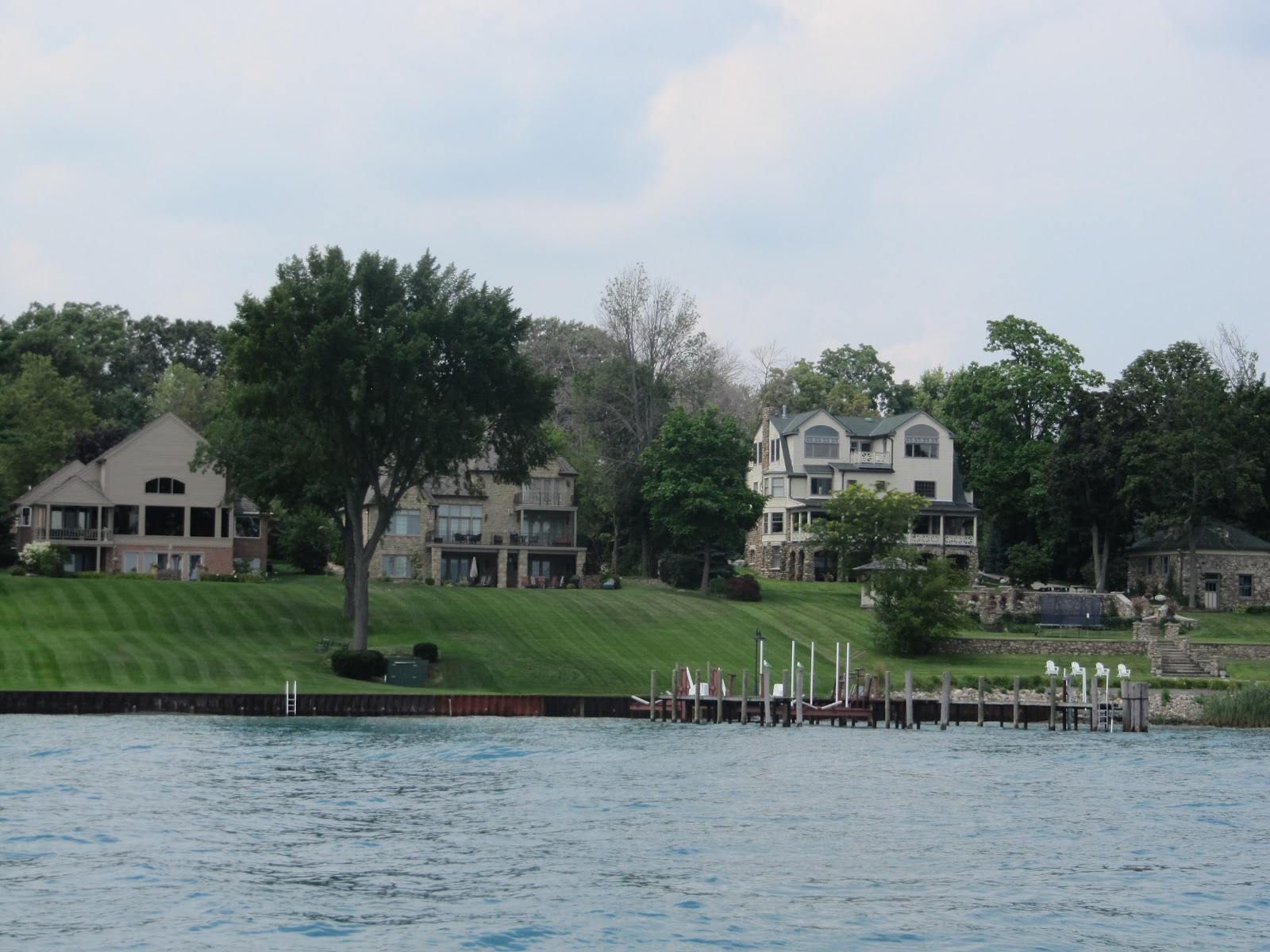
A few houses on the river just south of Port Huron


One of many ferry boats ecountered that cross from Canada to the U.S.


A large cruiser on her lift with some people making preperations.


An interesting looking "salty"


A wheelhouse from some long ago dismantled
boat, most likely a ferry boat, that is now used for a dock house.


This is part of the St. Clair flats, analagous to the Mississippi River Delta.  The location of the flats is right at the exit end of the St. Clair River where it empties into Lake St. Clair.  Harsen's Island is the big piece of real estate in the flats.  As kids we went with our parents many times to the Idle Hour Hotel on the island with the boat we had at the time.  The Idle Hour had a real nice dock for short term transients.  I think we were often longer term than they were happy with.  Johnny Schlagle, a popular Detroit radio DJ of the day was there one of the times we visitied.  The Idle Hour has since morphed from a hotel into a yacht club.  There was also a friend with a house on Harsen's Island on the water, with a dock who we would also visit from time to time.


A devleoped area of Harsen's Island showing a canal leading to houses off of the river.


Looking back at the last bit of land as we exit into Lake St. Clair.  The nice Sunday afternoon attracted many boats whose owners wanted to get into shallow water and enjoy the lake.  Our next few minutes took us right past JBM and on into the Detroit River where my usually sound planning skills took a dive.

Wednesday, January 11, 2012

Friday, July 30, 2010 to Sunday, Aug 1 Bayfield, Ontario to Bridge Harbor Marina @ Port Huron

Now to the project of clearing US customs.  Prior to leaving Bayfield, I called the US customs by phone and explained that we were unfamiliar with the process and could use any advice they could offer for our return to the US at Port Huron.  The gentleman on the other end was most helpful and gave me the "what to do items".  I followed his instructions when we arrived point by point.  Two agents, the "team" arrived at the boat and asked us for passports etc.  They completely wrecked my notion that this was going to be a nasty process.  They were complete but not overbearing.  What a nice surprise.

To get to the marina you find the entrance to the Black River off of the Saint Clair River and enter.  It is a long way up the Black River to the marina we selected, thru a number of bridges and past a bunch of yacht clubs, boat clubs and other marinas.  Bridge Harbor Marina was at the end point of the river that a boat of our size could easily navigate and true to its name it was right next to a very big local bridge that carries I-94 across the river.


We are getting some of our last looks at the Canadian shoreline as a Canadian visitor.  Thank you Canada for your hospitality and friendship to us as we traveled your waters.  In a couple of hours we will lower your national flag from our "starboard yard arm."


Still on Lake Huron and encountered our first "Salty"  A big freighter from across the ocean.  You can tell it is a salt water boat from her general shape and features.  Among them is the single large orange life boat half way up the "smoke stack" structure at the stern, pointed down at the water.  It is arranged this way to simplify deployment in an emergency.  You may have to enlarge the photo to see it.


This is a "laker."  Different features.  The evolution of lake freighters took a path to optimize the designs for these waters.  There are some lakers that are near 1000 feet in length.  This partially explains why there are many fewer boats on the lakes that in the 50's and 60's when I was familiar with Great Lakes shipping when a 600 footer was regarded as "giant."


Another "laker"


Coming up on the Blue Water Bridge that connects Sarnia with Port Huron.  Pretty structure and it is a main artery between Canada and the US.  It just so happened that we went under the bridge on the Canadian side.  It was an easy choice because that was the side most of the boats going our direction was on.  No traffic on that side was going the other way.  Turned out that was because the river current going south was intense on that side.  We could pick up the uptick in speed on our GPS equipment.


A correction to my statements regarding the intensity of the current, Canadian side vs the American side is in order.  Turns out I described it exactly backwards for a variety of reasons.  I did note the uptick in speed on the GPS but it appears that the uptick on the American side would have been even better.
My brother Tim who has extensive boating experience on the Great Lakes caught the error.  What follows is his text to me.  It contains lots of facts.


I just read your latest installment of the trip. I think you misstated something about the current in the St. Clair River as the water comes out of Lake Huron and into the river just above the bridge or I misinterpreted what you wrote. The current is much stronger on the American side than it is on the Canadian side. I have gone both ways on a variety of boats with a variety of owners and crews. Everyone is on the Canadian shore going north and the U.S. side of the channel until you can move close to U.S. shore going south.
I made the south bound trip on two boats that were equipped with both GPS and a paddle wheel knotmeter. I don't remember the exact difference in the speed reported on the two instruments but it was surprisingly large. I'm guessing the difference was in the range of 6 to 8 knots, possibly more. It is enough that most sailboats come close to standing still in the current going north on the U.S. side. The current is also slightly stronger in the spring with snow melt and run off than it is in the late summer.
When the Mackinaw sailboats leave the Black River before the race, they basically head straight across the river to the Candian side. They actually crab into the current enough that the current doesn't take them south of the Black River entrance, much as an airplane crabs into wind on a cross wind landing.


The traffic that is stuck in place is US bound.  Do you imagine that US customs is checking carefully?


The railroad bridge that carries some tracks across the Black River.  We are at the entrance.  Railroad bridges are always left in the up position, unlike highway bridges.  Since trains are infrequent and very predictable, they are left that way for the convenience of marine traffic.  They are only put in the "down" position when a train is about to need to cross.


A highway bridge opened for the river traffic, including us.  They open on a schedule.  If you miss the opening by just a little bit you will have to wait for the next opening cycle.


An 18 foot Chris Craft run about of the early 1950's vintage.  My dad had one exactly like this one in 1955 give or take.


A tiki party barge.  We encountered this one a couple of times.


A building along the river with Walcon Siding that was built probably in the mid 1950's.  It might be a municipal incinerator.


View from the main building of the Bridge Harbor Marina.  We are in there somewhere.


A fellow Floridian.


A dog with his own ramp to the boat.  More about him follows.


I guess this handsome dogs really likes boats!


And here are the dog's owners, Bud and Judy.  They keep their boat at the slip that just happened to be on the other side of the dock from us.  They were a treat to get to know.


The dog is at home on any boat.  Bud took Pat and I on a river tour aboard this Zodiac, sans Fido.  It was very scenic.  We got up to the entrance of the Black River Canal that was dug in 1908 to divert water from Lake Huron directly into the Black River as an attempt to flush sewage out of the Black River.  Remember, this was 1908.  We took the Canal almost to Lake St. Clair.  There is a control gate at that end of the canal which turned out to be closed.  That ended our travel down the Canal.


   Departing our marina in the Zodiac


A classic sail boat under what looks like continuous restoration.


Interesting name for a Bay Liner boat.


Back on shore.  Lots of horsepower here.  Look at where the driver sits.


We are once again headed to another port, this time to see my brother, Tim and his wife Kathy aboard their boat kept at Jefferson Beach Marina.  Should be fun.  The pilot boat ahead of us moved before he became a factor.


Monday, January 9, 2012

Thursday July 29, 2010 to Friday, July 30, Tobermory to Bayfield Ont.

This is our last leg in Canada.  It was my first visit to Lake Huron, in spite of the fact that I was raised in the Detroit area so many years ago.  This part of the trip was down the Canadian side of the lake from Tobermory to Bayfield.

We had in mind to link up with Ron and Sally aboard their Summer Star at Bayfield.  But alas, not to be. They got as far as Goderich, Ontario and called it a day.  They were beat up a bit by following seas.  Not so much effect on us because of our speed, allowing us to stay ahead of the wave chains.

A note about waves.  It was this ride that gave me the incentive to explore on the Internet a bit about waves and their speed.  I found an excellent surfing site, (water surfing) that explained waves and their movements in terms usable by the surfing crowd.  NOAA in their weather forecasts and data gives two parameters for waves.  One is their expected or measured height and the other is the time between crests.  It is the time between crests that is interesting.  It turns out that if you multiply the time period between crests in seconds times 3, you get the speed of the wave along the surface in knots.

So if a wave forecast is for 5 seconds between crests, that means that the wave chains are traveling at 15 knots across the surface and if you can not go at least this speed, you can not stay ahead of the waves chasing you from behind in a following sea.  15 knots is about 17 miles an hour.

Bayfield is just a bit north of Sarnia, Ontario. Sarnia  is right across the St. Clair River from Port Huron, MI   The marina we visited at Bayfield was the Harbor Lights Marina.  A most pleasant place to relax and regather your strength.       http://www.harbourlightsmarina.on.ca/ .


Looking back at the north end of the Bruce Peninsula with a large ferry boat heading toward Tobermory.  There are a lot of ferry boat routes that serve the many ports on Georgian Bay.


Looking back at the many islands at the north end of Bruce.


Looking ahead as we begin turning south down the shore of Canada on the east side of Lake Huron.


Here is a definite charted hazard to navigation in the form of rocks just breaking the surface.  They are far enough off shore that they would be unexpected were it not for the excellence of the available charts.  Any photo can be enlarged for better detail by clicking on it.


"On Plane"  We are traveling at 22 knots, nicely ahead of the building following seas which are not really visible in the photo.  We traveled at this speed from 11:17AM to 4:33PM when we arrived at the entrance to the Bayfield River.  The marina is located on the north shore of the river about half a mile in.


A view of Goderich, Ont. as we passed by.  Goderich is home to a large Compass Minerals plant and mine.  They mine the huge salt deposits deep down, providing the majority of the salt used for deicing roads in the winter in the entire Detroit, Windsor, Sarnia, Port Huron area.  http://en.wikipedia.org/wiki/Goderich,_Ontario .


In port.  Safely tucked in


Different view of the harbor from the deck of the Salt Shaker


A big stanchion to the left of the Salt Shaker.  It was once used to support a roadway across the Bayfield River.


The entire marina grounds were park like and well cared for.


A museum fire truck that resides at the marina.


Leaving Friday AM after fueling up and passing our slip on our way out.  The trip from Tobermory to Bayfield used 485 liters of gasoline or about 128 gallons.   Notice the stanchion mentioned earlier.  Next stop Port Huron, a visit from US customs and officially back in the US. 


Saturday, October 8, 2011

Monday July 26 2010 to July 29 Parry Sound to Tobermory via Wingfield Basin

Time to depart and head west back to Georgian Bay and thence to Tobermory located on the western side of the north shore of the Bruce Peninsula.  Bruce Peninsula separates Georgian Bay from Lake Huron all of which is on the Canadian side.  Our intention was to visit, anchoring overnight in Wingfield Basin which is at the east side of the north shore of Bruce on our way to Tobermory.

This basin was recommended by folks at Parry Sound so we expected to have an uneventful overnight.  Story in pictures below.


First marker out of Parry Sound Muni.


Sail boat encountered along the way.


Going toward Georgian Bay.


Red Rock Light with Georgain Bay beyond.  It is about 50 miles from there to the Bruce Penninsula.  Total trip about 80 miles.


We are in the Wingfield Basin.  The entrance is via a narrow channel and then thru a narrow cut in the rock and once inside you are in a pretty body of water.  There are a set of range lights to guide you to and thru the cut, it is that narrow,  but look what we found.  The place was was beautiful but absolutely crowded.  We found a place to anchor so we went thru the process.  Not holding, drifting back.  Try again.  Not holding drifting back.  One more try.  Same thing.  About then I remembered what Einstein was reported to have said about insanity.  He defined it as trying the same thing over and over again and expecting a different result.

The bottom is grass, weeds and mud.  More about that later.  The problem we had was the boat was equipped with the wrong type anchor for this kind of a bottom.  When we get back, I will replace the "plow type anchor" with a "Manson supreme," a very popular all around good anchor.  Thie Manson is made in New Zealand. 


Here is a wreck, one that has obviously been here in Wingfield for a real long time.  A note about these waters,  they are crystal clear, full of submerged wrecks, many dating back from the early 1800's  This is an extremely popular diving area.  Both amateur and professional.


Next issue.  What we found out later, was that we were in the middle of a sailboat regatta.  When we decided to take our leave, we could not get into the cut and the narrow channel leading to it because there was an endless string of boats arriving.  Finally after about 20 boats, the way was clear for us to depart.


Now about the mud and grass.  This what was left on the anchor after about 15 miles of 4 foot seas, each wave splashing past the anchor, taking a dose of mud and some grass from it and distributing it all over the boat.


Mud on the hatches and deck.


Mud on the windshied and the isenglass.  We left this mess on the boat for a couple of days.  Each passer by stopped at our boat and their question always was "how in the world did you do that?  Did you turn the boat upside down and drag it thru a wet muddy field?"  It was fun to tell the story.


This was the sign that greeted us in the Little Tub Marina.  Even better, our friends, Ron and Sally aboard the Summer Star also happened to be there and heard us on the radio arranging for a dock.  Them being there when we were was a pure concidence.  They had a speghetti dinner prepared for us on their boat.  What a treat after such a long day.

                                                http://en.wikipedia.org/wiPeninsulaki/Bruce_


Next day, they were on their way out, making their way back to their home in Sandusky, Ohio.


A 50 foot (approx) Chris Craft Roamer.  Steel hull built in the early 1960's.  This is a classic boat.  My dad had a 1960 model 36 foot Roamer Riveria, an express cruiser, like the Salt Shaker called the Iron Lady.  It was a fine boat, until she was allowed to sink at the marina where she was launched for the season with certain plugs not installed.  Local incompetence at its max.


And this was an endangered species.  One of the lock masters back on the Trent Severn offered us a dollar for every one we could bring him.  They are beautiful creatures but in sufficient numbers they can become a pain in the transom.


Here is a swim platform used as a jet ski platform.


That is the Salt Shaker at the end of the dock.


Tobermory is a historic Lake Huron/Georgian Bay seaport.  If you ask any boater on any of the Great Lakes they will almost always be familiar with what and where it is.  In the summer, it really bustles.


The Princess Hotel up on the hill.


The "admiral"


This is a Four Winns express cruiser.  About the biggest that can be transported on a trailer with out a permit.  Big truck, big trailer. experienced crew as well.


Here is a boat reverse towing a section of floating dock past our boat on his way to somewhere where it will be secured and used.


The population of Tobermory really shrinks in the winter.  However they have all the things you would expect.


Tobermory (Little Tub) Harbor from a ways up the road toward the entrance.


More history.


A fishing boat in a sort of dry dock.


This fellow was out there manouvering for quite a while.  It was a bit windy and he seemed to be a bit undecided about what he really wanted to do.  After a period of time he motored off.


An interesting plaque.


Another interesting plaque.


Another bit of historical information.


The upper deck of the Crowsnest Pub.  A great beer and a great sandwich was had here.


A view of the harbor from the upper deck of the pub.


After loading up on many liters of Canadian gas, we motor out past a commercial fishing boat.